Yukon Canada Map with Cities
Covering 482,443 square kilometers of rugged wilderness, the Yukon is a destination that demands respect and preparation. It is larger than California yet home to only about 46,000 people.
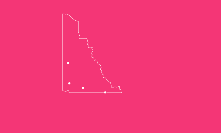
When planning a journey through this territory where moose outnumber humans two-to-one, having a reliable Yukon Canada map is not just helpful; it is a safety necessity.
How to Use the Map Tool on This Page
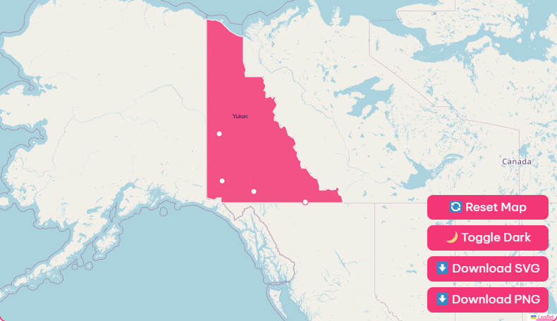
We have designed our interactive map to be the most comprehensive resource for navigating the territory. Here is how to get the most out of the features provided above:
Hover Highlight
Simply move your cursor (or tap on mobile) over any city, town, or park. A tooltip will appear displaying key data such as population, elevation, and main access roads.
Zoom In / Out
Use the + and – buttons in the bottom right corner to investigate complex areas, such as the streets of Whitehorse or the hiking trails of Kluane National Park.
Reset Button
Got lost in the wilderness? Click the “Reset” arrow to instantly return the view to the full territorial perspective.
Dark Mode Toggle
Planning your trip late at night? Click the moon icon in the top toolbar to switch the map interface to dark mode, reducing eye strain.
Download Options
For travelers heading into remote areas, digital reliance is a risk. Cell service is non-existent on large stretches of the Dempster and Campbell Highways. We recommend downloading these offline versions:
- Blank Printable SVG: Ideal for classroom use or itinerary sketching.
- High-Res PNG: Perfect for keeping on your phone or tablet for offline viewing.
Historical Overview of Yukon
To understand the map of the Yukon, you must understand the events that drew lines on it. Before 1898, this region was part of the Northwest Territories. The catalyst for change was gold.
1896
Gold was discovered on Rabbit Creek (later Bonanza Creek), sparking the Klondike Gold Rush.
1898
The sudden influx of over 100,000 stampeders required a local government. The Yukon Act was passed, officially establishing the Yukon Territory. Dawson City served as the bustling capital.
1942
The construction of the Alaska Highway shifted the center of gravity south.
1953
The capital was officially moved from Dawson City to Whitehorse, reflecting the new economic reality of road transport over river transport.
Geographical Overview of Yukon
The territory is triangular, bordered by the US state of Alaska to the west, the Northwest Territories to the east, and British Columbia to the south. The northern edge meets the Beaufort Sea.
The geography is defined by the Yukon Plateau, which is encircled by massive mountain ranges. In the southwest, the Saint Elias Mountains contain Canada’s highest peaks, including Mount Logan (5,959 meters).
The central artery of the territory is the Yukon River. As the second-longest river in Canada, it flows northwest from British Columbia, through Whitehorse and Dawson City, crossing into Alaska before emptying into the Bering Sea.
Important Yukon Insights
Before you pack your bags, review these key statistics. They highlight just how unique this territory is compared to the rest of North America.
- Total Area: 482,443 km² (Roughly 4.8% of Canada’s land mass).
- Total Population: ~46,000.
- Population Density: 0.1 people per km².
- Capital City: Whitehorse (Home to approx. 78% of the total population).
- Highest Point: Mount Logan (5,959 m).
- Official Tree: Subalpine Fir.
- Wildflowers: Over 1,250 distinct species.
List of Yukon Famous Cities and Towns
While many maps show “cities,” the Yukon essentially has one true city (Whitehorse) and several towns and unincorporated communities. Here is a breakdown of the major hubs you will see on the map.
| Community | Status | Key Highlight | Best Known For |
| Whitehorse | City (Capital) | S.S. Klondike National Historic Site | The main hub for flights, supplies, and government. |
| Dawson City | Town | Diamond Tooth Gerties Gambling Hall | The heart of the Klondike Gold Rush; historical architecture. |
| Watson Lake | Town | Sign Post Forest | The “Gateway to the Yukon” on the Alaska Highway. |
| Haines Junction | Village | Da Kų Cultural Centre | The operational base for Kluane National Park. |
| Carcross | Unincorporated | Carcross Desert | World-class mountain biking and Tlingit history. |
| Teslin | Village | Teslin Tlingit Heritage Centre | Indigenous culture and fishing on Teslin Lake. |
| Mayo | Village | Binet House Museum | The Silver Trail and mining history. |
| Old Crow | Settlement | Vuntut National Park Access | The only Yukon community accessible only by air; Vuntut Gwitchin culture. |
Overview of Yukon’s Geography and Regions
Understanding the map requires breaking the territory into distinct travel regions.
Klondike Region
Located in the west-central Yukon, this area is steeped in history. The landscape here is unglaciated, meaning it features unique geological formations called “tors.”
The Dempster Highway begins near Dawson City, shooting north toward the Arctic.
Southern Lakes
This accessible region surrounds Whitehorse. It is characterized by long, deep, turquoise lakes like Tagish, Marsh, and Bennett. It serves as a playground for boaters in summer and aurora viewers in winter.
Kluane Region
Dominating the southwest, this is the land of giants. Massive icefields and Canada’s highest peaks define the skyline. The Alaska Highway runs along the edge of the park, offering some of the most scenic driving in the world.
Silver Trail
Central Yukon is home to the Silver Trail, accessed via the Klondike Highway. It leads to Mayo and Keno City, offering a quieter, off-the-beaten-path look at mining history distinct from the gold rush.
Top Attractions and Landmarks
When viewing the map, look for these specific markers to plan your itinerary.
- Sign Post Forest (Watson Lake): A collection of over 80,000 signs brought by travelers from around the world.
- Emerald Lake (South Klondike Highway): A glacial lake famous for its intense green color caused by marl deposits.
- Tombstone Territorial Park: Often called the “Patagonia of the North,” this park on the Dempster Highway features jagged black granite peaks.
- S.S. Klondike (Whitehorse): A restored sternwheeler that offers a glimpse into the riverboat era.
- Carcross Desert: Often cited as the world’s smallest desert, this is actually a series of sand dunes left by a glacial lake.
Outdoor Activities and Adventures
The map is your menu for adventure. Here is what the geography allows you to do:
- Paddling: The Yukon River offers a classic multi-day canoe trip from Whitehorse to Dawson City (approx. 700km).
- Hiking: From the easy loops around Miles Canyon to the multi-day Chilkoot Trail (currently requiring careful permit planning due to flood damage), the trails are endless.
- Aurora Viewing: While visible everywhere, the open skies of the Southern Lakes region provide prime viewing from late August to April.
- Flightseeing: In the Kluane region, the terrain is so rugged that small aircraft are the only way to see the icefields and Mount Logan up close.
Tips for Safe and Responsible Travel
A map alone cannot keep you safe. The Yukon environment is unforgiving.
- Mind the Gap (in Service): Do not rely on Google Maps. Cell service disappears minutes outside of communities. Carry paper maps or download offline GPS data.
- Wildlife Awareness: You are in bear country. Keep a clean camp, carry bear spray, and know how to use it. Do not stop in the middle of the highway to photograph wildlife; pull over safely.
- Respect Indigenous Land: Much of the Yukon is traditional territory of Yukon First Nations. Respect private property, follow local guidelines, and do not disturb historical artifacts.
- Check Road Conditions: The 511 Yukon website is your best friend. Road closures due to washouts, fires, or snow are common.
Frequently Asked Questions
What is the capital of the Yukon?
Whitehorse is the capital city. It has held this title since 1953, taking over from Dawson City.
How many people live in the Yukon?
As of 2024 estimates, the population is approximately 46,000 people.
How big is the Yukon compared to US states?
The Yukon is roughly the same size as California (approx. 423,000 km²) but slightly larger at 482,443 km².
Is the Yukon a province?
No, it is a territory. The distinction lies in jurisdiction; provinces derive power from the Constitution Act, while territories derive power from the federal government.
Can I drive to the Arctic Ocean from the Yukon?
Yes. You can take the Dempster Highway to the Inuvik-Tuktoyaktuk Highway, which leads all the way to the Arctic Ocean. It is the only public road in Canada that crosses the Arctic Circle.
What is the distance between Whitehorse and Dawson City?
The driving distance is approximately 532 kilometers (330 miles) via the North Klondike Highway.
What time zone is the Yukon in?
The Yukon is on Yukon Standard Time, which aligns with Pacific Standard Time. However, the Yukon does not observe Daylight Saving Time changes, meaning it stays on UTC-7 year-round.
Are there paved roads in Yukon?
Yes, major arteries like the Alaska Highway and Klondike Highway are paved. However, secondary roads (like the Dempster) are gravel and require sturdy tires.
What is the coldest temperature ever recorded in Yukon?
The village of Snag recorded -63°C (-81.4°F) in 1947, the lowest temperature ever recorded in continental North America.
Do I need a passport to visit Yukon?
If you are entering from the United States (Alaska), yes, you need a passport to cross the international border. Canadians traveling domestically do not.
Discovering the Magic of Yukon
Whether you are navigating the streets of Whitehorse or plotting a course through the remote valleys of the Tombstone ranges, this territory offers adventure on a scale few other places can match.
Ready to see it for yourself?
[Explore Our Full Yukon Travel Itineraries].