Ontario is a study in contrasts. It is home to Canada’s bustling financial hub and its quietest, most rugged wilderness.
It holds the seat of the federal government and 250,000 freshwater lakes. For travelers, students, and business professionals, understanding the layout of this massive province is essential.
Covering more than 1 million square kilometers, an area larger than France and Spain combined, Ontario is Canada’s most populous province, home to over 16.1 million people.
Navigating it requires more than just a compass; it requires an understanding of its distinct regions, from the fertile vineyards of the Niagara Peninsula to the mineral-rich Canadian Shield in the north.
How to Use the Map Tool on This Page
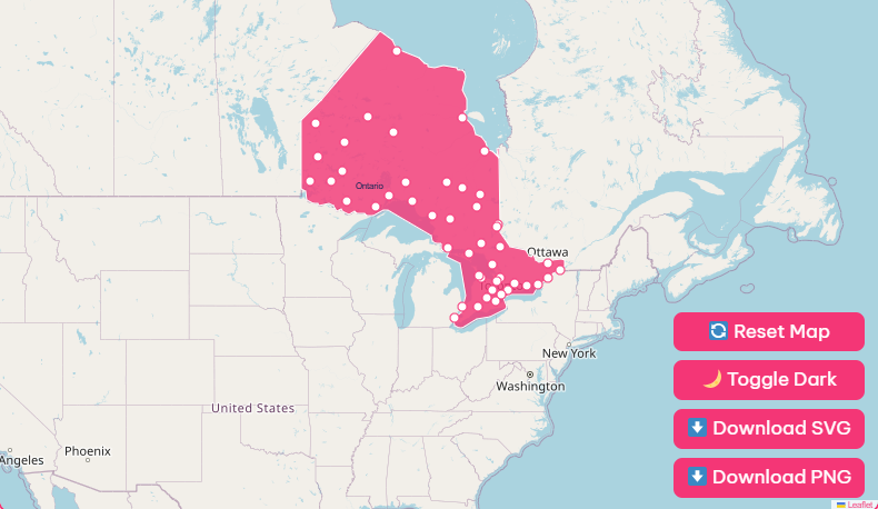
To help you visualize the province, we have designed our map tool with user-friendly features suitable for research or travel planning.
Zoom and Pan
Use the + and – buttons in the top right corner to zoom in on dense areas. Click and drag to move across the province.
Hover Highlight
Hover your cursor over any city dot to see a pop-up containing the city’s population and key landmarks.
Dark Mode
Prefer a high-contrast view? Switch the toggle at the bottom left to “Dark Mode” for easier viewing in low-light environments.
Reset View
If you get lost in the backroads of Algonquin Park, simply hit the “Reset” button to return to the full provincial overview.
Map Download Options
We understand that sometimes you need a static map for a presentation, classroom setting, or offline navigation. We offer high-resolution downloads free of charge.
- High-Res PNG: Ideal for digital presentations or website usage.
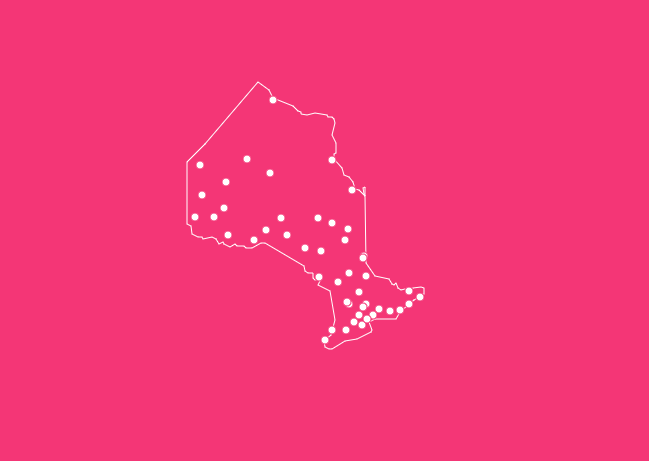
- Blank Outline (SVG): Perfect for students practicing geography or designers creating custom graphics.
Historical Overview of Ontario
Understanding the map of Ontario requires looking back at the history that shaped its borders and cities. People have inhabited this land for more than 12,000 years.
The name “Ontario” itself is derived from the Iroquois word kanadario, meaning “sparkling water”, a fitting name for a province where water defines the landscape.
Before European settlement, the land was stewarded by Algonquian and Iroquoian-speaking Indigenous peoples.
The map began to change significantly in 1791 with the Canada Act, which split the province of Quebec into Upper Canada (now Ontario) and Lower Canada (now Quebec).
Newark (now Niagara-on-the-Lake) served as the first capital, but it was moved to York (now Toronto) in 1793 to better protect it from American attacks.
Since Confederation in 1867, Ontario has grown from a colony of 235,000 people to an economic powerhouse of over 16 million, yet the historical footprints remain visible in the layout of its oldest cities like Kingston, Ottawa, and Toronto.
Geographical Overview: The Three Belts
When viewing an Ontario map, it is helpful to divide the province into three distinct geographical regions. These belts dictate where cities are located and where the wilderness takes over.
1. The Hudson Bay Lowlands
Located in the far north, this area borders Hudson Bay and James Bay. It is a vast wetland region featuring tundra and distinct subarctic forests.
It is virtually uninhabited, with no major road networks connecting it to the south. Communities here, such as Fort Severn and Attawapiskat, are primarily accessible by air or winter ice roads.
2. The Canadian Shield
Covering approximately two-thirds of the province, the Canadian Shield is ancient bedrock rich in minerals like nickel, gold, and copper. This rugged landscape is characterized by thin soil, exposed rock, and boreal forest.
While sparsely populated compared to the south, it is the heart of Ontario’s mining and forestry industries. Cities like Sudbury and Thunder Bay serve as the major urban hubs in this vast region.
3. The St. Lawrence Lowlands
This region may be the smallest in size, but it is the heavyweight in terms of population and economy. Located in the south, bounded by the Great Lakes and the St. Lawrence River, this area features fertile soil and a moderate climate.
This is where you will find the majority of Ontario’s arable land, its largest cities, and the highest density of highways and infrastructure.
Major Cities on the Ontario Map
Ontario’s urban centers are diverse, ranging from global metropolises to historic limestone cities.
Toronto
As the provincial capital and the largest city in Canada, Toronto is the anchor of the “Golden Horseshoe.” It is the country’s financial, industrial, and cultural center.
On the map, it sits on the northwestern shore of Lake Ontario. Landmarks like the CN Tower and the Royal Ontario Museum define its skyline.
Ottawa
Located in Eastern Ontario on the banks of the Ottawa River, this is Canada’s national capital.
While it is a government town, it has also earned the nickname “Silicon Valley North” due to its thriving technology sector. It is home to Parliament Hill and the Rideau Canal, a UNESCO World Heritage site.
Hamilton
Often called the “Ambitious City,” Hamilton is a port city located at the western end of Lake Ontario. Historically known for steel production, it has transformed into a hub for health sciences and arts.
It is geographically defined by the Niagara Escarpment, which cuts through the city, creating over 100 waterfalls within the city limits.
London
Situated in Southwestern Ontario, London is a key educational and medical hub, home to Western University. It is located at the forks of the Thames River, roughly halfway between Toronto and Detroit, Michigan.
List of Famous Ontario Cities
To help you orient yourself, here is a breakdown of key cities, their regions, and what makes them notable.
| City | Region | Known For |
| Toronto | Golden Horseshoe | Provincial Capital, CN Tower, Finance |
| Ottawa | Eastern Ontario | National Capital, Parliament, Tech Sector |
| Niagara Falls | Niagara Region | Horseshoe Falls, Tourism, Hydroelectricity |
| Kitchener-Waterloo | Southwestern Ontario | Technology, Oktoberfest, Universities |
| Sudbury | Northern Ontario | Nickel Mining, Science North, The “Big Nickel” |
| Kingston | Eastern Ontario | Historic Limestone Architecture, Queens University |
| Thunder Bay | Northwestern Ontario | Port on Lake Superior, Gateway to the West |
| Windsor | Southwestern Ontario | Automotive Industry, Border crossing to Detroit |
| Sault Ste. Marie | Northern Ontario | Soo Locks, Steel Industry, Agawa Canyon |
| Stratford | Southwestern Ontario | Stratford Festival (Theater), Victorian Architecture |
Regional Breakdown and Highlights
A flat map can’t capture the distinct vibe of each region. Here is what you will find on the ground.
Southwestern Ontario
Surrounded by Lake Huron, Lake Erie, and Lake St. Clair, this region effectively functions as a peninsula. It is known for having the best freshwater beaches in the province and arguably the best sunsets.
It is an agricultural heavyweight and home to the southernmost point in Canada, Middle Island, which sits at the same latitude as Rome, Italy.
The Niagara Region
This is one of the most famous spots on the global map.
Beyond the breathtaking Horseshoe Falls, the region is Ontario’s premier wine destination, thanks to a unique microclimate that allows for the cultivation of grapes including those used for the world-famous Icewine.
Greater Toronto Area (GTA)
The GTA is Canada’s most multicultural urban center. It is a sprawling metropolis that includes Toronto and its surrounding municipalities like Mississauga, Brampton, and Markham.
From major league sports to an exceptional foodie culture, this is the pulse of the province.
Northern Ontario
When you look at the map, Northern Ontario is everything north of Lake Huron and the French River. It is a four-season playground for outdoor enthusiasts.
Whether you are skiing in the winter, fishing in the summer, or watching the Northern Lights, this region offers an escape from the urban density of the south.
Southeastern Ontario
Rich in history, this area runs along the St. Lawrence River and Lake Ontario. It includes Kingston, Canada’s first capital city, and the stunning Thousand Islands.
The pace here is slower, defined by limestone architecture, river cruises, and heritage sites.
Lakes, Rivers, and Waterways
You cannot discuss an Ontario map without discussing water. The province’s name is literal; water is everywhere.
The Great Lakes
Ontario borders four of the five Great Lakes: Superior, Huron, Erie, and Ontario. These lakes hold one-fifth of the world’s fresh surface water.
Freshwater Legacy
Beyond the Great Lakes, the province contains over 250,000 smaller lakes.
Manitoulin Island
Located in Lake Huron, this is the world’s largest freshwater island, covering 2,766 square kilometers.
Major Rivers
The Ottawa River forms much of the border with Quebec, while the St. Lawrence River is a vital shipping artery connecting the Great Lakes to the Atlantic Ocean.
Transportation and Infrastructure
Connecting a province this size requires massive infrastructure.
Highways
The 400-series highways are the arteries of Southern Ontario. Highway 401, which cuts across the south from Windsor to the Quebec border, is one of the busiest highways in North America.
Rail
Via Rail provides passenger service along the Quebec City-Windsor corridor and the transcontinental “Canadian” line. GO Transit is a regional network connecting the GTA and Golden Horseshoe.
Ontario Northland services the northern regions, including the “Polar Bear Express” to Moosonee.
Public Transit
Toronto utilizes the TTC (subway and streetcars), Ottawa moves people via OC Transpo (Light Rail), and Waterloo Region uses the Ion system.
Important Ontario Insights
Population Density
Despite the huge landmass, over 85% of Ontarians live in urban centers, primarily clustered along the shores of the Great Lakes in the south.
Economy
Ontario generates 37% of Canada’s national GDP. It is a manufacturing heartland (especially for automobiles) and a leader in tech and financial services.
Time Zones
Most of the province is in the Eastern Time Zone. However, the western portion of Northern Ontario (west of Thunder Bay) observes the Central Time Zone.
Frequently Asked Questions
What is the current population of Ontario?
As of recent estimates, Ontario is home to approximately 16.1 million people, representing nearly 40% of Canada’s total population.
How big is Ontario physically?
Ontario covers 1.076 million square kilometers. To put that in perspective, it is larger than France and Spain combined.
What is the highest point in Ontario?
The highest point is Ishpatina Ridge, located in the Temagami region, standing at 693 meters (2,274 feet) above sea level.
How many lakes are there in Ontario?
There are more than 250,000 lakes in Ontario. Together, they contain about 20% of the world’s fresh surface water.
What is the longest distance across the province?
The province is vast. The longest east-west distance is 1,568 kilometers, and the longest north-south distance is 1,691 kilometers.
Does Ontario have its own time zone?
Ontario spans two time zones. The majority is in the Eastern Time Zone, while the region west of 90° W longitude (near Thunder Bay) is in the Central Time Zone.
How much of the population is urban vs. rural?
Ontario is highly urbanized, with more than 85% of its population living in urban centers, mostly in the Golden Horseshoe region.
Is Toronto the capital of Canada?
No. Toronto is the provincial capital of Ontario. Ottawa is the national capital of Canada.
How extensive is the Great Lakes shoreline in Ontario?
The combined shoreline of the Great Lakes in Ontario is roughly equal to 45% of the earth’s circumference.
What is the largest freshwater island in the world?
Manitoulin Island, located in Lake Huron, Ontario, holds this title. It is large enough to have over 100 inland lakes of its own.
Start Your Ontario Journey
Ready to explore? Don’t forget to use the interactive features at the top of this page to plan your route, or save a copy of the map for the road.
[Download Your Free High-Res Ontario Map].