Manitoba is often called the “Heart of Canada,” and for good reason.
Located in the longitudinal center of the country, this province is a meeting place of diverse landscapes, cultures, and history.
From the polar bear-filled tundras of the north to the vibrant, wheat-filled prairies of the south, navigating this vast territory requires a keen understanding of its geography.
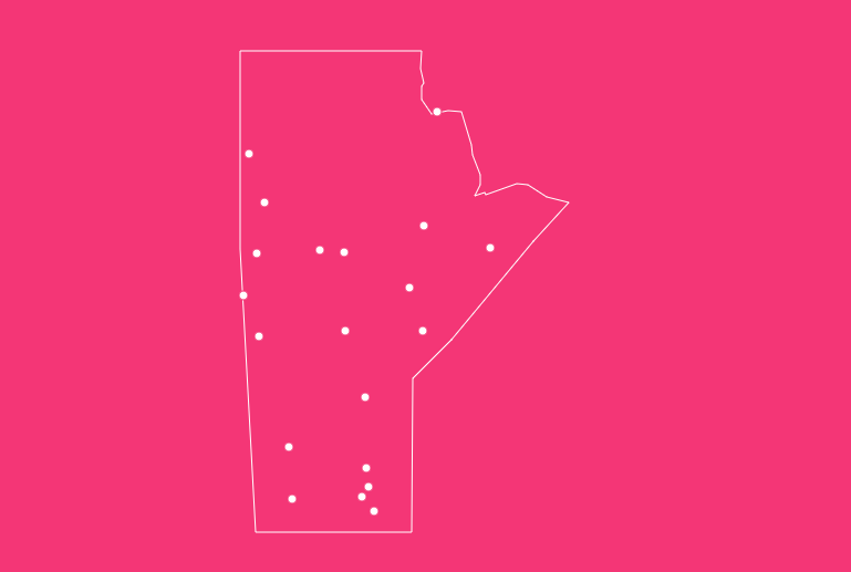
How to Use the Map Tool on This Page
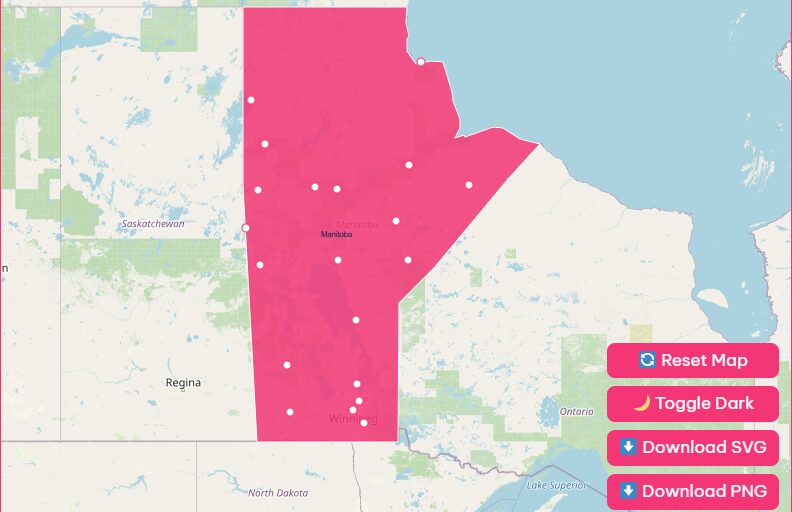
Navigation Features
Hover Highlight
Simply move your mouse cursor (or tap with your finger on mobile) over specific cities or regions.
Zoom In / Out
Use the + and – buttons located in the top right corner of the map interface to adjust the view.
Reset Button
If you have zoomed in too far or lost your bearings, click the “Reset” button to instantly return the map to its default, province-wide view.
Dark Mode Toggle
Prefer a different aesthetic or viewing in low light? Switch the toggle at the top of the map to “Dark Mode” for a sleek, high-contrast version of the map.
Download Options
For those who need a map offline or for print purposes, we offer high-resolution downloads.
Blank Printable SVG
Ideal for students and teachers, this scalable vector graphic allows you to print a blank outline of the province for educational exercises.
High-Res PNG
Download a detailed image file that includes all city names, major roads, and geographical markers, perfect for inclusion in reports or travel itineraries.
Geographical Overview of Manitoba
Understanding the map of Manitoba requires looking at the physical foundation of the province.
Manitoba covers a massive area of 647,797 square kilometers (250,116 square miles). It is the easternmost of the three Prairie Provinces, yet it serves as the gateway to Western Canada.
The geography is surprisingly diverse. While many assume it is entirely flat, the province actually sits on two distinct geological areas.
To the south and west, you have the Manitoba Escarpment and the prairies, which feature rolling hills and fertile soil ideal for agriculture.
To the north and east lies the Canadian Shield, a rugged terrain of ancient granite rock, boreal forest, and thousands of lakes.
The province is bordered by:
- Nunavut to the north
- Hudson Bay to the northeast (Manitoba is the only prairie province with a saltwater coastline)
- Ontario to the east
- United States (North Dakota and Minnesota) to the south
- Saskatchewan to the west
Historical Overview of Manitoba
Before it was a province mapped with highways and cities, Manitoba was the ancestral land of the Cree, Ojibway, Oji-Cree, Dene, and Dakota peoples, and later the homeland of the Métis Nation.
The name “Manitoba” is believed to be derived from the Cree “Manito-wapow” or the Ojibway “Manito-bau,” both roughly translating to “the strait of the spirit” or “place where the spirit speaks.”
This refers to the roaring sound made by waves crashing against the limestone rocks of Lake Manitoba.
Here is a brief timeline of the province’s evolution:
1670
The Hudson’s Bay Company was granted a monopoly over the region (then Rupert’s Land), establishing a fur trade economy.
1812
The Red River Colony was established, marking the first agricultural settlement.
1870
Following the Red River Resistance led by Louis Riel, the Manitoba Act was passed, and Manitoba became the first province to join the Confederation after the original four.
1912
The boundaries were extended north to the 60th parallel, giving Manitoba its current shape and size.
Exploration of Major Cities and Towns
When looking at a map of Manitoba with cities, you will notice that the population is heavily concentrated in the south.
However, important communities serve as hubs throughout the northern and western regions.
Winnipeg
As the capital and largest city, Winnipeg is home to over half of the province’s population.
Located at the historic forks of the Red and Assiniboine Rivers, it is a cultural and economic powerhouse.
Key landmarks to look for on the map include The Forks National Historic Site, the Canadian Museum for Human Rights, and the Royal Canadian Mint.
Brandon
Known as the “Wheat City,” Brandon is the second-largest city in Manitoba. It serves as a major hub for the agricultural sector in the southwest corner of the province.
It is located along the Assiniboine River and hosts the Royal Manitoba Winter Fair.
Churchill
Located on the shores of Hudson Bay in the far north, Churchill is famous worldwide as the “Polar Bear Capital of the World.”
Though small in population, it is massive in significance for tourism and research. It is accessible only by train or plane, making it a unique location on any map.
List of Famous Manitoba Cities
Below is a quick reference guide to some of the key urban centers you will find on our map.
| City | Region | Known For |
| Winnipeg | Capital Region | The Forks, Cultural Arts, NHL’s Winnipeg Jets |
| Brandon | Westman | Agriculture, Keystone Centre |
| Steinbach | Eastman | Mennonite Heritage Village, Automobile Sales |
| Thompson | Northern | Nickel Mining, Gateway to the North |
| Portage la Prairie | Central Plains | Island Park, Agriculture |
| Winkler | Pembina Valley | Manufacturing, Rapid Growth |
| Dauphin | Parkland | Countryfest, Ukrainian Heritage |
| Flin Flon | Northern | Mining, built on volcanic rock |
| Selkirk | Interlake | Steel Industry, Catfish Capital |
Manitoba’s Lakes and Rivers
You cannot look at a map of Manitoba without noticing the blue. Water covers approximately 16% of the province’s surface area.
Lake Winnipeg
The 10th largest freshwater lake in the world. Its beaches, particularly Grand Beach, are summer hotspots.
Lake Manitoba & Lake Winnipegosis
These massive lakes run parallel to Lake Winnipeg and are remnants of the ancient glacial Lake Agassiz.
Red River
Flowing north from the United States, this winding river is famous for its fertile valley and, historically, its flooding.
Assiniboine River
This river meets the Red River in Winnipeg and stretches west across the province into Saskatchewan.
Analysis of Road and Railway Networks
Manitoba acts as a transportation funnel for Canada. Because of the rugged terrain of the Canadian Shield to the north of the Great Lakes, all cross-country ground traffic is funneled through Winnipeg.
Highway Network
- Trans-Canada Highway (Highway 1): The main artery running east-west through Winnipeg and Brandon.
- Yellowhead Highway (Highway 16): Branches off west of Portage la Prairie, heading toward Saskatoon and Edmonton.
- Highway 75: The primary route heading south from Winnipeg to the US border (connecting to I-29).
Railways
Railways were the backbone of Manitoba’s development. Winnipeg remains a major rail hub for both CN and CPKC railways.
The Hudson Bay Railway is particularly notable on the map, as it runs north through permafrost terrain to connect The Pas to the port of Churchill.
Provincial Parks and Points of Interest
Our map highlights the green spaces that make Manitoba an outdoor lover’s paradise.
Riding Mountain National Park
An “island” of wilderness rising out of the prairie cropland. It is home to moose, black bears, and a captive bison herd.
Whiteshell Provincial Park
Located in the Canadian Shield, this park offers incredible hiking trails, clear lakes, and granite cliffs.
Pimachiowin Aki
A UNESCO World Heritage Site. This area protects the largest remaining tract of boreal shield forest on Earth and celebrates the cultural landscape of the Anishinaabeg.
Important Manitoba Insights
When studying the map, keep these insights in mind regarding the province’s economy and lifestyle:
Central Time Zone
Manitoba is in the Central Standard Time (CST) zone.
Hydroelectric Power
If you look at the Nelson River on the map, you are looking at the source of much of the province’s power. Manitoba Hydro is a major exporter of clean electricity.
Agriculture
The southern portion of the map represents some of the most productive farmland in the world, producing canola, wheat, and oats.
Frequently Asked Questions
What is the capital city of Manitoba?
Winnipeg is the capital city. It is the economic and cultural center of the province and is located at the confluence of the Red and Assiniboine Rivers.
Why is Manitoba called the “Land of 100,000 Lakes”?
The nickname is actually a modest estimate. Manitoba has over 110,000 lakes, which cover a significant portion of the province’s total area, providing immense freshwater resources.
Can I drive to Churchill, Manitoba?
No, there are no all-weather roads connecting Churchill to the rest of the province. You can identify it on the map in the far north, but you must take a train or a plane to get there.
What is the main highway crossing Manitoba?
The Trans-Canada Highway (Highway 1) is the primary east-west route. It passes directly through Winnipeg and Brandon.
Does Manitoba have mountains?
While it does not have mountain ranges like the Rockies, it features the Manitoba Escarpment. The highest point is Baldy Mountain in Duck Mountain Provincial Park, sitting at 832 meters (2,730 ft).
Where is the best place to see Polar Bears?
Churchill is the best place. It sits on the migration path of polar bears moving toward Hudson Bay as the ice freezes.
Is Manitoba a prairie province?
Yes, it is one of the three Prairie Provinces, along with Saskatchewan and Alberta. However, the prairie landscape is mostly found in the southern and western parts of the province.
What is the population of Manitoba?
As of recent estimates, the population is approximately 1.4 million people, with the majority living in the Winnipeg Capital Region.
What borders Manitoba to the north?
Manitoba is bordered by the territory of Nunavut and the Hudson Bay coastline to the north.
Plan Your Manitoba Adventure Today
Manitoba is a province that rewards exploration. From the urban excitement of Winnipeg to the silent, starry skies of the north, there is a destination on this map for every type of traveler.
Ready to explore? Download your free high-resolution map of Manitoba now and start planning your route!