Canada is a land of staggering scale and diversity.
Spanning nearly 10 million square kilometers, it stretches from the temperate rainforests of the Pacific coast to the rugged cliffs of the Atlantic, and northward to the icy peaks of the Arctic.
For educators, business planners, and travelers alike, visualizing this vast expanse can be a challenge. Static maps often fail to capture the dynamic nature of the country’s political and physical geography.
Understanding Canada’s Geographic Divisions
To truly understand the map of Canada, one must first grasp the political and regional divisions that structure the nation.
While they may look similar on a map, there are distinct legal and cultural differences between the landmasses.
What is the difference between a Province and a Territory?
Canada consists of ten provinces and three territories. The primary difference lies in their constitutional authority.
Provinces exercise constitutional powers in their own right. They are co-sovereign divisions that receive their authority directly from the Constitution Act, 1867.
This means the federal government cannot easily alter their powers or boundaries.
Territories, on the other hand, exercise powers delegated to them by the federal Parliament.
While they have elected assemblies and function similarly to provinces in many daily affairs, their existence and powers are ultimately derived from federal statutes.
Regional Groupings
Geographers and economists often group these jurisdictions into five distinct regions:
Atlantic Canada
Newfoundland and Labrador, Prince Edward Island, Nova Scotia, and New Brunswick. Known for fisheries, maritime history, and coastal tourism.
Central Canada
Quebec and Ontario. Despite the name, they are geographically central-eastern but house the majority of the population and manufacturing industries.
The Prairies
Manitoba, Saskatchewan, and Alberta. Famous for flat agricultural land, oil production, and vast skies.
Western Canada
British Columbia. Defined by the Rocky Mountains and the Pacific Ocean.
Northern Canada
Yukon, Northwest Territories, and Nunavut. Characterized by the Arctic climate, Indigenous culture, and mining resources.
Geography of Canada: A Physical Overview
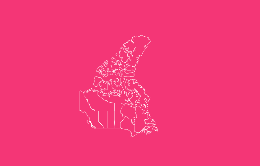
Beyond political borders, Canada is defined by its ancient bedrock and diverse landscapes. An interactive map helps visualize how these physical features intersect with human settlement.
Physical Geography and Landforms
Canada’s landmass is comprised of seven distinct physiographic regions, each with its own topography and geology:
Canadian Shield
The geologic core of the country, covering nearly half of Canada. It is rich in minerals and forests but has thin soil, making it less suitable for agriculture.
Cordillera
The mountainous region in the west (BC and Yukon), featuring the Rockies and Coast Mountains.
Interior Plains
The flat, fertile lands between the Shield and the Cordillera, serving as Canada’s breadbasket.
Great Lakes-St. Lawrence Lowlands
The smallest but most populous region, hosting major cities like Toronto and Montreal.
Appalachian Region
Rolling hills and valleys covering Atlantic Canada and parts of Quebec.
Hudson Bay Lowlands
A vast wetland area southwest of Hudson Bay.
Arctic Lands
The islands and permafrost terrain of the far north.
Climate Zones and Biomes
Canada is divided into 15 terrestrial ecozones, ranging from the lush Pacific Maritime zone in the west to the frozen Arctic Cordillera in the north.
The Boreal Shield is the largest ecozone, stretching across the country and acting as a massive carbon sink.
Understanding these zones is crucial for environmental studies and resource management.
Environmental Zones
From the permafrost of the North which presents challenges for infrastructure, to the temperate zones of southern Ontario that support wine country, Canada’s environmental diversity is immense.
Our interactive map allows users to visualize these zones, aiding in everything from agricultural planning to climate change research.
Key Features of Our Interactive Canada Map
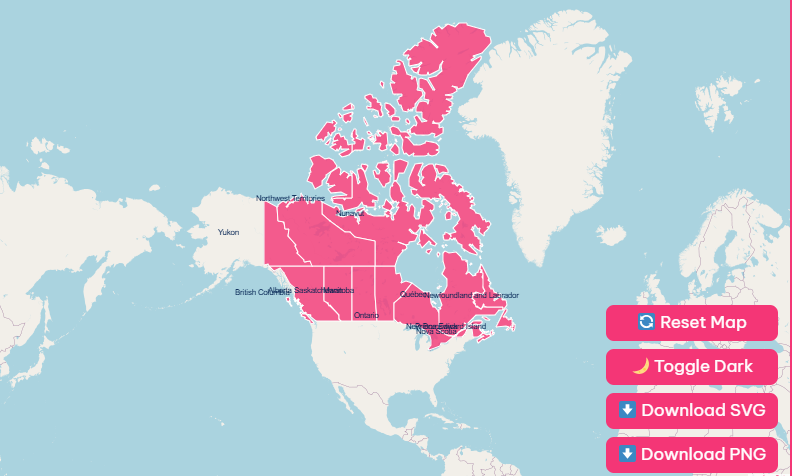
We have designed our map to be more than just a reference image. It is a utility tool designed for flexibility.
1. Hover Highlight & Tooltips
As you move your cursor over the map, each province and territory illuminates. This hover highlight feature instantly separates borders, allowing for quick identification of smaller regions like Prince Edward Island.
2. Dark Mode Toggle
Whether you are working late or presenting in a low-light environment, the dark mode toggle switches the map’s interface to a sleek, high-contrast dark theme.
3. Reset Button
Exploring complex data? The reset button instantly reverts the map to its original state, clearing any selections or zooms you have made, so you can start fresh without reloading the page.
4. Downloadable Blank Maps (SVG & PNG)
Need a map for a classroom worksheet or a business report? You can download the map in high-resolution PNG or scalable vector graphics (SVG) formats.
The SVG option is particularly powerful for designers, as it allows you to edit individual province shapes in software like Adobe Illustrator.
5. Zoom and Pan
Canada is wide. Our zoom and pan functionality allows you to focus on the dense cluster of provinces in the Maritimes or zoom out to see the full scope of the Northern territories.
Benefits of Using an Interactive Map
Educational Purposes
For students, interactivity breeds engagement. Clicking through the history of Nunavut or visualizing the size of Quebec compared to France helps retain geographical knowledge.
Business Planning
Sales managers can use the map to designate sales territories.
By visualizing the population distribution (see below), businesses can identify high-density markets in the Great Lakes region versus resource-rich markets in the Prairies.
Travel Planning
Tourists can trace the Trans-Canada Highway, clicking on provinces to see major attractions, helping them understand the vast distances between stops like Thunder Bay and Winnipeg.
Exploring Each Province and Territory
Here is a brief overview of what you will find when exploring the map, moving from West to East, then North.
British Columbia (BC)
- Capital: Victoria
- Key Features: Defined by the Pacific coastline and mountain ranges. It is a hub for forestry, film production, and technology.
- Highlight: Home to the Great Bear Rainforest.
Alberta (AB)
- Capital: Edmonton
- Key Features: The heart of Canada’s energy sector. It features both the stunning Rocky Mountains (Banff/Jasper) and vast flat prairies.
- Highlight: Canada’s largest producer of oil and natural gas.
Saskatchewan (SK)
- Capital: Regina
- Key Features: Known as the “Breadbasket of Canada,” it is a global leader in potash and uranium production.
- Highlight: The land of “Living Skies” due to its flat horizon and spectacular sunsets.
Manitoba (MB)
- Capital: Winnipeg
- Key Features: A meeting point of the prairies and the Canadian Shield. It has over 100,000 lakes.
- Highlight: Churchill, Manitoba is the “Polar Bear Capital of the World.”
Ontario (ON)
- Capital: Toronto
- Key Features: The most populous province and the economic engine of Canada. It houses the nation’s capital, Ottawa.
- Highlight: Contains Niagara Falls and the Toronto Stock Exchange.
Quebec (QC)
- Capital: Quebec City
- Key Features: The center of French culture in North America. It is the largest province by area and a massive producer of hydroelectricity.
- Highlight: Quebec City is the only fortified city north of Mexico.
New Brunswick (NB)
- Capital: Fredericton
- Key Features: The only officially bilingual province. It is known for its forestry and the Bay of Fundy tides.
- Highlight: The Hopewell Rocks.
Nova Scotia (NS)
- Capital: Halifax
- Key Features: A peninsula surrounded by the Atlantic. It is famed for its seafood (lobster) and shipbuilding history.
- Highlight: The Cabot Trail, one of the world’s most scenic drives.
Prince Edward Island (PEI)
- Capital: Charlottetown
- Key Features: Canada’s smallest province. Famous for red sand beaches, potatoes, and Anne of Green Gables.
- Highlight: The Confederation Bridge connects it to the mainland.
Newfoundland and Labrador (NL)
- Capital: St. John’s
- Key Features: The most easterly point of North America. It has a rich history of fishing and a growing offshore oil industry.
- Highlight: L’Anse aux Meadows, a Viking settlement predating Columbus.
Yukon (YT)
- Capital: Whitehorse
- Key Features: Famous for the Klondike Gold Rush. It contains Canada’s highest peak, Mount Logan.
Northwest Territories (NWT)
- Capital: Yellowknife
- Key Features: A land of diamonds and auroras. It features the Mackenzie River, Canada’s longest river system.
Nunavut (NU)
- Capital: Iqaluit
- Key Features: Canada’s newest and largest territory (created in 1999). It is governed by a consensus-style government and is a stronghold of Inuit culture.
Natural Resources by Region
An interactive map is an excellent way to visualize Canada’s economic engine:
Energy
Concentrated in Alberta (oil sands), Newfoundland (offshore oil), and British Columbia (natural gas). Quebec and Manitoba are leaders in Hydroelectricity.
Forestry
Dominant in British Columbia, Quebec, and Northern Ontario.
Mining
The Canadian Shield (spanning Ontario, Quebec, and the North) is rich in gold, nickel, and copper. Saskatchewan provides the world with potash.
Agriculture
The Prairies (AB, SK, MB) produce wheat, canola, and cattle. Ontario and BC have significant fruit and vegetable sectors.
Language and Cultural Regions
Canada is officially bilingual, but the map reveals distinct linguistic pockets:
Francophone
Majority in Quebec, with significant populations in New Brunswick (Acadians), Eastern Ontario, and Manitoba.
Anglophone
Majority in most other provinces.
Indigenous Languages
In Nunavut, Inuktitut is a primary official language. The Northwest Territories recognizes 11 official languages, reflecting its diverse Dene, Métis, and Inuvialuit heritage.
List of Canada Provinces and Territories at a Glance
The following data provides a snapshot of the current demographic landscape.
| Province/Territory | Capital City | Population (Est. 2025) | Area (Total km²) |
| Ontario | Toronto | ~16,182,641 | 1,076,395 |
| Quebec | Quebec City | ~9,111,629 | 1,542,056 |
| British Columbia | Victoria | ~5,722,318 | 944,735 |
| Alberta | Edmonton | ~4,960,097 | 661,848 |
| Manitoba | Winnipeg | ~1,504,023 | 647,797 |
| Saskatchewan | Regina | ~1,250,909 | 651,036 |
| Nova Scotia | Halifax | ~1,079,627 | 55,284 |
| New Brunswick | Fredericton | ~858,963 | 72,908 |
| Newfoundland & Labrador | St. John’s | ~545,579 | 405,212 |
| Prince Edward Island | Charlottetown | ~179,280 | 5,660 |
| Yukon | Whitehorse | ~47,126 | 482,443 |
| Northwest Territories | Yellowknife | ~45,074 | 1,346,106 |
| Nunavut | Iqaluit | ~41,414 | 2,093,190 |
Frequently Asked Questions
How many provinces and territories does Canada have?
Canada has 10 provinces and 3 territories.
Which is the largest province in Canada by area?
Quebec is the largest province by total area. However, Nunavut is the largest territory, covering one-fifth of Canada’s landmass.
What is the most populous province?
Ontario is the most populous, home to approximately 40% of Canadians.
What is the difference between the Canadian Shield and the Interior Plains?
The Canadian Shield is a rocky, forested region rich in minerals, while the Interior Plains are flat, fertile lands ideal for agriculture.
Which province is officially bilingual?
New Brunswick is the only province in Canada that is constitutionally bilingual (English and French).
What are the three territories of Canada?
Yukon, Northwest Territories, and Nunavut.
Can I download a blank map of Canada for printing?
Yes, our interactive tool allows you to export a blank SVG or PNG map for educational or printing purposes.
What is the newest territory in Canada?
Nunavut was separated from the Northwest Territories and established as its own territory on April 1, 1999.
Where are the Rocky Mountains located?
The Canadian Rockies are located in Western Canada, running along the border of British Columbia and Alberta.
Does the map show time zones?
While the political map shows borders, Canada spans six time zones: Newfoundland, Atlantic, Eastern, Central, Mountain, and Pacific.
Visualize the Data Today
Whether you are teaching the next generation of geographers or strategizing your business expansion, having the right visual tools makes all the difference.
Ready to explore?
[Download Free Map].